

It’s no secret that Byford and its surrounding suburbs sit precariously atop a seasonal floodplain; water cascading down from the Darling scarp during the persistent winter rains has historically caused issues of waterlogging in the areas to the west of the South Western Highway.
But many of the more-than-thirty flood-impacted Darling Downs residents who attended the meeting with the shire last week said this year has been the worst they’ve ever seen.
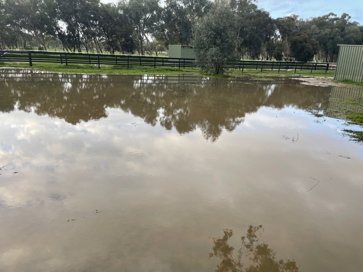
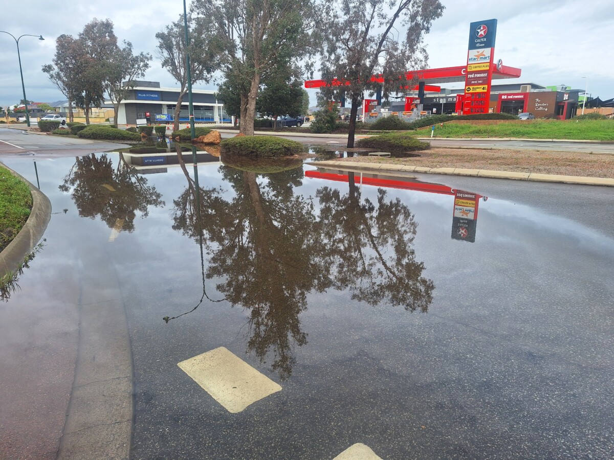
Whole properties, roads and even the substation on Thomas Rd were under about six inches of water during a 65mm downpour earlier this month. And every rain event since has caused further damage.
A couple on Butcher Rd said the sheer amount of water that swept through their property overnight on August 7 washed their entire driveway down to the rear of their block.
“The force of it bent fences and gates,” they said.
“I was shocked at the torrent that was coming down,” Phil Petricevich, whose family has owned a property on Kentucky Drive West for 20 years, said.
“And the worst part is the ground is so sodden now there’s nowhere for that water to go anymore – it’s just sitting there.”
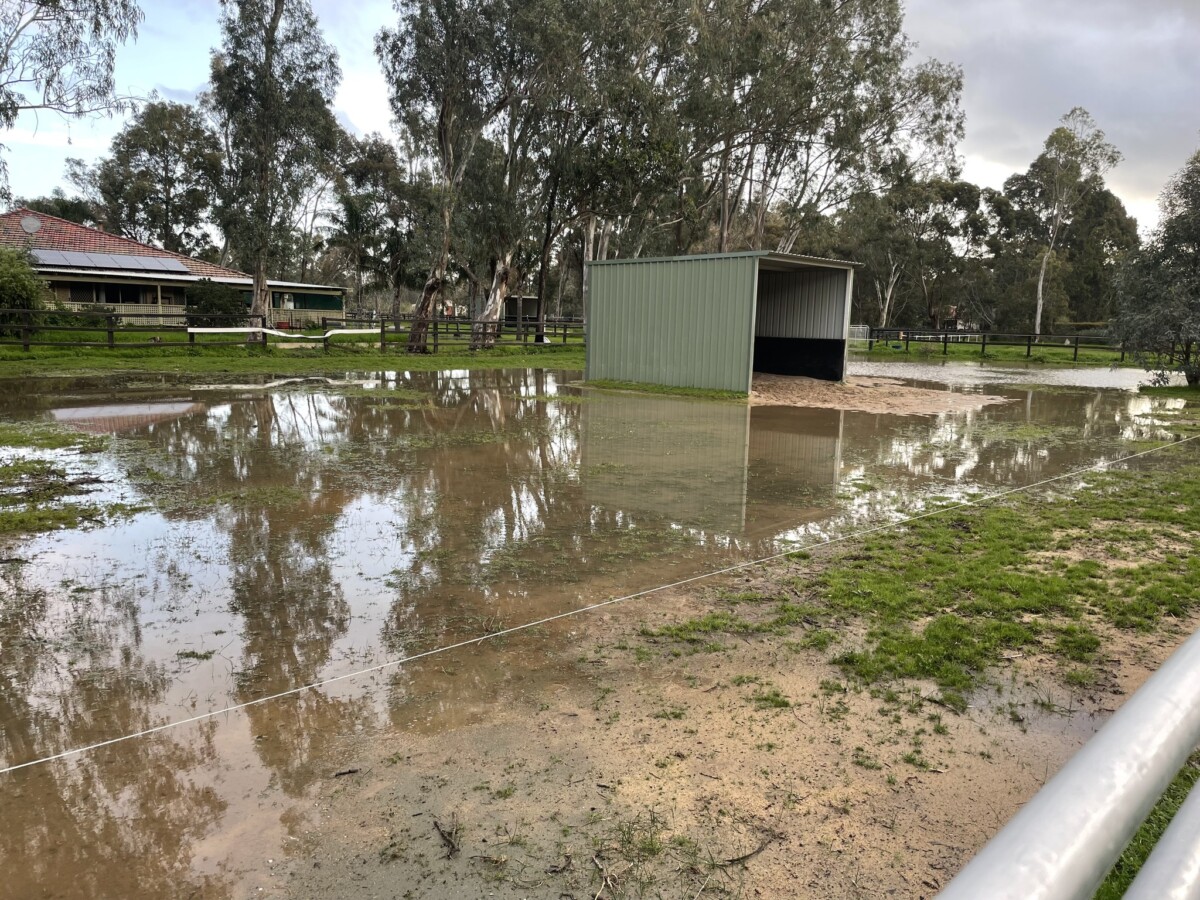
For many locals in the equine industry, their properties are not just their homes, but their livelihoods too.
Phil is currently agisting two horses at his property.
They’ve also got two brood mares to foal down soon, and they’ll have to agist them out if the pasture dies off after the flooding.
“We put six tonne of lime out in late May, and fertiliser, and that’s all gone,” he said.
“Once you get a setback like this, there’s a good chance of not getting in the pasture growth which means we might have to buy in more hay.”
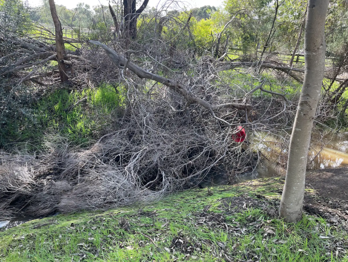
And with all the shallow pools of water hanging around, unable to permeate the heavy clay soils, the mosquitoes are already starting to bolster their ranks.
So why has the flooding gotten so bad?
Logic dictates the more land that gets developed around town, the less potential for the rain to soak into the ground – something which was forewarned in the Shire of Serpentine Jarrahdale’s 2004 Byford Townsite Detailed Area Plan.
But the problem is a lot more hydra-headed than that, as was revealed at the meeting.
Brendan Foley, special counsel acting on behalf of the developers of the new estate at the Thomas Rd end of Wungong South Rd, put in his two cents about where the troubles flow from, after considerable research on the matter.
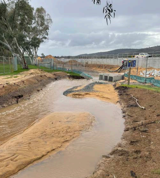
According to Mr Foley, the rail reserve to the south of Thomas Rd used to have sumps with large water storage capacity, and have since been filled during the rail line upgrade. These sumps used to act as a buffer for the torrents rolling down from the foothills.
“And the new culverts under the rail line are massive in diameter – there’s the potential for thousands of litres per second to be crossing the railway reserve,” he said.
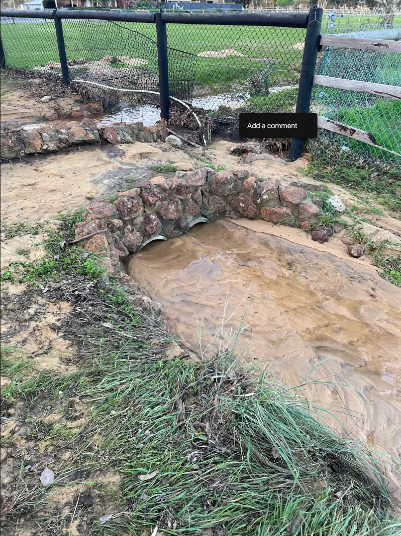
Likewise, sections of the drains that line either side of Thomas Rd have been either partially or completely filled in during the Thomas Road bridge project. Historically, Thomas Rd has been a main waterway during major rain events, and forms a major part of the Oaklands Drain North system.
The narrow culvert under Thomas Rd at George St that used to restrict water flow to a reasonable level, has been replaced with a tunnel large enough to drive a car through, according to Mr Foley.
And typical water-slowing measures like rock check dams, were not installed in the reconstructed drainage network when it was completed.
But Metronet denies their drainage upgrades have had any impact on the levels of stormwater pouring from their culverts and into the Darling Downs’ open drains.

“We have engaged extensively with residents who live in the area after new drainage was installed and a culvert upgraded as part of the works,” a Metronet spokesperson said.
“The outflow conditions from the new drainage and culvert remain unchanged.”
But Metronet failed to respond to questions about the filling in of the open drains along Thomas Rd.
To muddy the waters even further, the yellow sand from the rail line upgrade has started to run off site and clog many of the already overloaded drains – something which Metronet said they are trying to remedy.
“The team has been working to clear any excess sand from the drains in the area and continues to monitor rainfall levels,” the spokesperson said.
“To assist with sediment control, temporary batter stabilisation and rock check dams have been installed across the project.”
Phil Petricevich generally agrees with Mr Foley’s assessment of Metronet’s culpability in this mess, but is adamant that it’s not all on them.
He has spent the last two weeks following the drainage network through the area to understand the cause of the issue.
“The system is overloaded. I see it as a funnel, and everyone’s trying to put more water in the top but no one’s looking at the bottom,” he said.
“The shire has been asleep at the wheel – they haven’t maintained the drainage system west of the rail line and it’s now all coming home to roost. Many of the drains are overgrown and chock-a-block with branches.”
Shire Director of Infrastructure Services Reza Najafzadeh said his team had been making more of an effort to clear drains, with 20km cleared per year across the shire over the past three years.
“But the shire has 800km of roads and nearly 600km of these are country roads with open drains – it comes down to resources,” he said.
Shire CEO Paul Martin said his officers are currently devising a policy which allows local residents to burn out nearby drains again as a means to combatting this issue.
Mr Petricevich also believes that poor planning management and ‘bad principles’ have meant not enough new developments have been saddled with the requirement to install compensation basins.
“And the basin that is in the new estate on Wungong South Rd is so shallow that water was gushing out at a million miles an hour when we had the 65mm downpour,” he said.
“I know that these problems have been inherited by the current CEO and council, but that’s beside the point.
“I’m absolutely staggered that they’ve known about this since 2018, when they did their own flood modelling, and they’ve done nothing.”
CEO Paul Martin explained they’d only recently come to realise that all the flooding issues were likely to be ‘interrelated’ instead of multiple isolated events as previously thought. It’s possible the same issues are even feeding into the embarrassing situation at Kardan Boulevard.
Some at the meeting expressed concern the problems will be compounded even further when the tarmac is laid for the new train station and its carpark, and work finally begins on the Tonkin Highway Extension.
“This is the first time the shire has listened to us about the problem – so thank you. But something needs to happen now,” one resident said.
Phil Petricevich believes the problems could be alleviated by diverting the flow of water northwards along the rail line towards the Wungong Brook.
Brendan Foley, similarly, believes there could be a fairly simple solution to this quagmire: “They just need to restore the original capacity of the drains and culverts along Thomas Rd.”


